


Beyond the mostly traffic free Waterlink Way, Route 21 continues southwards out of London for adventures into Surrey and towards the south coast.
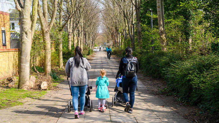
For a relaxed family cycle ride or if you use a wheelchair, handcycle or pushchair we recommend the Waterlink Way between Ladywell fields and Lower Sydenham.
Information on this page
- Places to see and explore
- Local amenities
- Public transport
- Local loops
- Continue on the National Cycle Network
- Continue walking
- Accessibility information
Places to see and explore
- Historic Maritime Greenwich including the Cutty Sark, the Royal Naval College and the Greenwich meridian.
- The Thames, Deptford Creek, Ravensbourne River and the Pool River
- Spot artworks and murals between Lewisham and Lower Sydenham.
- Ladywell Fields – playground, sports facilities, café, toilets and one of the great trees of London.
- Cator Park
- South Norwood Country Park
- The grounds of Bethlem hospital and Bethlem museum of the mind (free entry)
Local amenities
- Frequent local shops, cafes and pubs in Greenwich, Deptford, Lewisham, Ladywell and Catford.
- Ladywell Fields: Good Hope Café
- Lower Sydenham: local shops and services
- Kent House: local shops and services
- Addington and New Addington: local shops and services
Public transport
By train: Greenwich, Deptford, St Johns, Ladywell, Catford, Lower Sydenham, New Beckenham, Kent House, Clock House, Birkbeck, Elmers End.
Docklands Light Railway (DLR): Deptford Bridge, Elverson Road, Lewisham.
By tram: Beckenham Road, Birkbeck, Harrington Road, Elmers End, Arena (Wimbledon – Beckenham/Elmers End line), Addington Village, Fieldway, King Henry’s Drive, New Addington (New Addington – West Croydon line).
Find out more about using public transport to get to the National Cycle Network on our ‘Get started on London’s National Cycle Network’ page.
Local loops
We recommend these local circular routes for family friendly, traffic free and accessible adventures.
- This circular 5 mile Waterlink Way route between Catford and Cator Park is flat and mostly traffic free.
- This 3 mile Tram and lake loop in South Norwood Country Park is flat and traffic free.
Continue on the National Cycle Network
Want to explore more of the National Cycle Network from this route?
Follow these directions to find other National Cycle Network routes near here:
From Greenwich, take the Thames Path east to Dartford on Route 1 or take the Thames Path west to Putney on Route 4.
From Greenwich go via the Greenwich foot tunnel to join Route 1 northbound to Docklands, the Lea Valley and Cheshunt.
From New Addington continue south on Route 21 to Reigate, Crawley and Eastbourne.
Continue walking
Want to explore more of London’s walking network from this route?
Find out which other routes you can join from Route 21:
At Greenwich join the Thames Path National Trail eastbound or westbound (south bank route).
At Greenwich join the Jubilee Greenway eastbound or westbound.
At Cator Park join the Capital Ring eastbound or westbound.
At Cator Park join the Green Chain Walk eastbound or westbound.
At Addington join the London Loop eastbound or westbound.
Join the Greenwich Meridian Trail northbound or southbound at Greenwich, Lower Sydenham or New Addington.
Find more useful information about walking in London on our Get started on London's National Cycle Network page.
Accessibility information
Between Greenwich and Kent House this route is mostly suitable for relaxed leisure walking, cycling and wheeling. This information focusses on this section.
South of Kent House this route is mostly on road and is suitable for people who are confident cycling on road.
Barriers
In Lower Sydenham there is a chicane barrier at Fambridge Close.
At the south end of Kangley Bridge Road there is a chicane barrier.
At the Kings Hall Road entrance to Cator Park there is a chicane barrier. This can be avoided by using Aldersmead Road.
At Kent House station there are two chicane barriers. Please walk cycles through the station.
The entrance to South Norwood Country Park from Elmers End road is a narrow gateway. There is a wider entrance 100m to the southeast.
At Croydon Arena tramline crossing there are two chicane barriers.
At Long Lane there is a chicane barrier.
At Parkfields recreation ground there are two barriers that require cycles to be lifted.
Surface
In South Norwood Country Park paths are hard packed gravel. Near Croydon Arena the path is a narrow rough track for 200m.
On Shirley Heath, Bridle Road path is a hard packed woodland path.
Steeps and steps
In Ladywell Fields this route uses a bridge to cross the railway which has a steep ramp or shallow steps. This can be avoided by taking quiet Doggett Road to cross the railway at Catford Road.
In South Norwood Country Park there is a short steep hill near the tramline crossing in the park.
South of South Norwood Country Park the route undulates towards the North Downs.
Take care
This route has these busier on road sections.
At Ladywell, this route uses busy Ladywell Road (B236) for 100m.
At Catford, this route uses an industrial estate carpark for 100m. Be careful of HGVs.
At Kent House, this route uses busy local Kings Hall Road for 150m. This can be avoided by using Aldersmead Road.
Between Kent House and South Norwood Country Park, for 1km, this route uses Churchfields Road and Beck Lane which can be busy. For 150m, it uses very busy Elmers End Road (A214).
At Addington, this route uses busy local Spout Hill for 500m.
Please note
We have taken all responsible steps to ensure that these routes are safe and achievable by people with a reasonable level of fitness.
However, all outdoor activities involve a degree of risk. To the extent permitted by law, Sustrans accepts no responsibility for any accidents or injury resulting from following these routes.
Walking and cycling routes change over time. Weather conditions may also affect path surfaces.
Please use your own judgement when using the routes based upon the weather and the ability, experience and confidence levels of those in your group.