The National Cycle Network criss-crosses the entire United Kingdom, running through spectacular rural countryside and past many hidden urban gems. Many of these routes are not just great to cycle but are perfect for a leisurely amble on foot. We've asked our teams from around the UK to tell us their favourite walks.
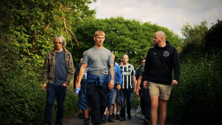
The Men.Talk.Walk group, based in Caerphilly and led by Shaun Cook, is harnessing the benefits of walking outdoors to help men with their mental health. Credit: Kenyons

Donate to Sustrans
We're the charity making it easier for everyone to walk, wheel and cycle. Will you join the movement with a donation of £10 today?
The Caledonia Canal, Scotland - National Cycle Route 78
From: Corpach train station, nr. Fort William To: Gairlochy
Distance: 8 miles (3 hours one-way)
Follow the gentle off-road path alongside the Caledonia Canal to experience some of the Great Glen’s most majestic scenery.
Setting off from the northernmost banks of Loch Linnhe, the route runs alongside Neptune’s Staircase, a stunning feat of engineering which raises the Caledonian Canal by 67 feet over a quarter of a mile stretch.
The path continues in the formidable shadow of Ben Nevis and provides stunning vistas towards the Grampian Mountains.
Your finishing point is the southern bank of Loch Lochy beside the "Pepperpot" lighthouse - a perfect picnic spot at the water’s edge.
Strathyre to Mhor 84 Motel (or Lochearnhead), Scotland - National Cycle Route 7
From: Strathyre, to: Mhor 84 or Lochearnhead Hotel
Distance: 2.5 miles (50 minutes one-way) or 6 miles (2 hours one-way)
This stunning, traffic-free walk begins in the village of Strathyre and meanders through the vivid seasonal colours of Strathyre Forest and the rugged surrounding landscape of Rob Roy Country.
If it's open, you can make a break along your route at Mhor 84 to enjoy fresh food sourced locally.
Continue along the path towards Lochearnhead where, after a brisk climb, spectacular views across Loch Earn await.
En route, keep an eye out for some very Scottish characters - a unique selection of sculptures created by local artists.
The wooded Killecrankie Gorge, a rich conservation area, is another great walk on National Route 7
Maerdy Mountain to Rhigos, Glamorgan - National Cycle Route 47
From: Llanwonno, To: Craig Y Llyn
Distance: 9.3 miles (3 hours)
With fantastic views to the Brecon Beacons, this is a day out not to be missed.
Begin at the lovely pub, the Brynffynon in Llanwonno and follow signs for Route 47 into the coniferous Gwynno Forest.
Through the trees spot the remains of old Roman Camps and views of the Cynon and Rhondda valleys.
The top of Maerdy Mountain marks the halfway point. Carry on towards Lluest-wen Reservoir and Rhondda Fach Windfarm.
After a short detour off Route 47 along the edge of the forest, the path heads north-west to reach Craig Y Llyn (Rhigos Mountain) and yet more spectacular views.
The Peregrine Path, Wye Valley - National Cycle Network 423
From/To: Monmouth
Distance: 12 miles (5 hours to complete)
This unique traffic-free route straddles the England and Wales border within the Wye Valley Area of Outstanding Natural Beauty.
It follows the River Wye through the upper Wye Gorge and connects Monmouth to Symonds Yat, where there are a variety of cafes and pubs right by the river to refuel and enjoy a well-earned rest.
For the more adventurous, there is the option at Symonds Yat to climb the steep and winding path (500ft) up to the Symonds Yat Rock.
Here you can see panoramic views of the gorge and the possibility of nesting peregrine falcons hunting on the nearby cliffs.
The Crab and Winkle Way takes you through ancient broadleaved woodland to the seaside town of Whitstable
The Crab and Winkle Way, Kent - National Cycle Route 1
From: Canterbury West Train Station, To: Whitstable
Distance: 7.5 miles (3 hours)
Harbour views, varied landscape and plenty of local history feature at either end of this beautiful walk.
Starting at Canterbury West station, follow signs to the university along the edge of Beverley Meadow and out of the city to the University of Kent.
You'll pass by colourful woodland on your way to National Cycle Route 1, a traffic-free path.
Enjoy the varying views and landscapes as your route meanders north to Whitstable's train station.
Join the Stream Walk footpath to continue all the way to the harbourside, where you can admire the fantastic views across the estuary.
The ‘Triangle’ bus route from the harbour will bring you back to Canterbury.
Coate Water Park to Hodson, Swindon - National Cycle Route 45
From / To: Coate Water Park
Distance: 6 miles (3 hours)
This walk begins at Coate Water Country Park, a 56-acre reservoir built in the 1820s. Starting from the car park, make your way along the east side of the lake to meet the track signed Route 45.
Follow the signs to the edge of Chiseldon, where you’ll see views back over Swindon.
Footpaths to Hodson will take you through a pretty chalk valley and past the Calley Arms pub.
After Hodson, return along the footpath to Route 45, just north of the motorway.
Keep your eyes peeled for local wildlife as you complete your walk in Coate Water Park's nature reserve, this time taking the west side of the lake.
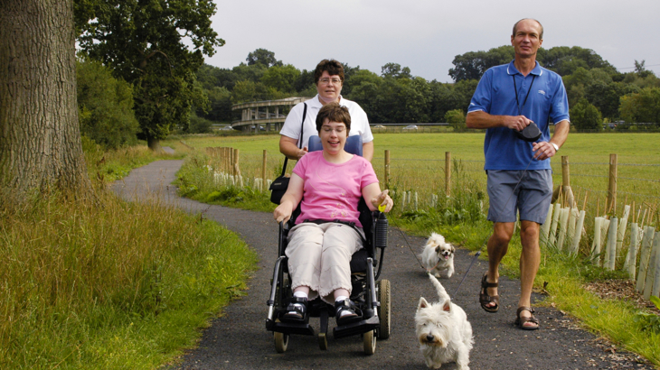
Many stretches of the National Cycle Network, including Route 45 here, are traffic-free and fully accessible to all users
Penistone to Dunford Bridge, Trans Pennine Trail - National Cycle Network 62
From/To: Penistone Train Station
Distance: 13 miles return journey (4 hours to walk there and back)
This beautiful walk takes you from the busy market town of Penistone to the rolling moors of the Peak District at Dunford Bridge.
This quiet and traffic-free path is surrounded by wildflowers in Spring and follows the route of the old Great Central Railway.
The walk takes you through glorious countryside, with stunning views across a valley.
On your way, don’t forget to visit the Magic Wood just beyond Hazlehead Bridge Station. Also worth exploring is Wogden Foot Nature Reserve, an important habitat for wildlife alongside the route as it approaches Dunford Bridge.
The Flitch Way, Braintree to Rayne - National Cycle Network 16
From/To: Braintree Railway Station
Distance: 5 miles (1.5 hours)
This easy five-mile route takes you through Flitch Way Country Park from Braintree to Rayne and back again.
Starting at Braintree Station, follow signs for Essex County Council Flitch Way Country Park.
From here, you’ll walk through deep gorges, open vistas over farmland, and past delightful mature oak trees.
It’s worth noting that the route climbs gently from the Pods Brook Road Bridge up to the Victorian Rayne Booking Hall Café, situated in the former Station Masters House.
If it's open, you can stop off here for a coffee and light snack before retracing your steps.


