

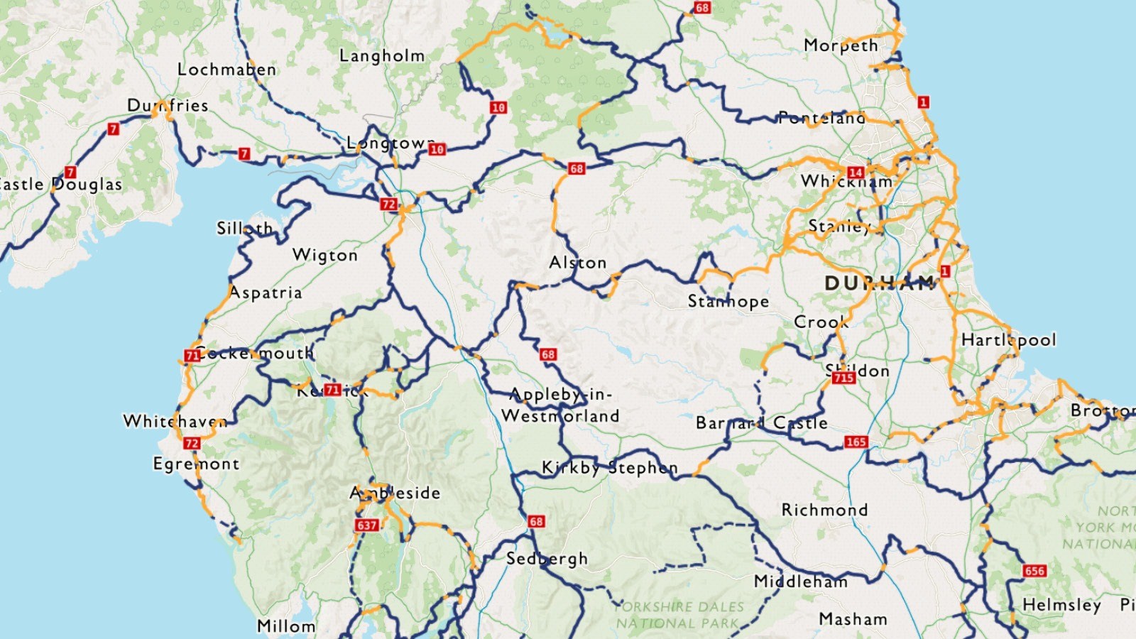
The Sea to Sea (C2C) can start at either Whitehaven or Workington, and has two possible endpoints on the North Sea coast in Sunderland or Tynemouth.
There are some sections of the Whitehaven to Sunderland route that are not part of the National Cycle Network.
Sea to Sea route sections from west to east (Whitehaven to Sunderland)
1. Whitehaven to Keswick
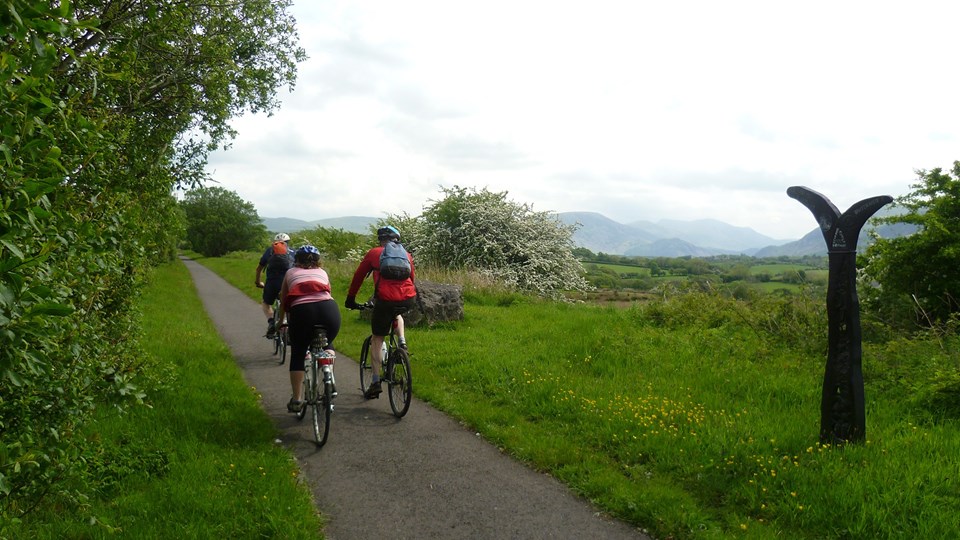
Starting at Whitehaven; an old seaport on the west coast of Cumbria. The first ten miles of the C2C follow a well made surfaced path.
Quiet lanes follow as the route passes through some of the country's most beautiful scenery.
Kirkland and Lamplugh reveal the proximity of the Lakes mountains and on the steep descent from Fangs Brow to Loweswater there is a good view of Mellbreaks ahead.
The Whinlatter Pass is the first major climb ending in a fine descent on forest roads to Bass Lake and Keswick.
2. Keswick to Langwathby
The next section of the Sea to Sea route takes the route on to Langwathby in the Eden Valley and has contrasting views and riding surfaces.
Alternate routes exist here, with the hardest one crossing Matterdale Common on the Old Coach Road to Greystoke, Blencow and the town of Penrith, reaching Langwathby on the Eden.
At this point a third of the ride is now complete, leaving behind the hills of the Lakes, with the Pennine crossing to come.
3. Langwathby to Allenheads
The most mountainous part of the route with four major climbs in 20 miles.
The first encountered and steepest is Hartside at 580 metres; this is the watershed between the Irish Sea and the North Sea.
It’s not all downhill from here. After Hartside, the route passes near Alston, reaching Garrigill and the old lead mining areas at Nenthead and Allenheads, reaching the highest part of the C2C at 609 metres on Black Hill.
4. Allenheads to Consett
This section of the C2C marks the end of the rough hilly terrain of the North Pennines and the start of the industrial landscape of the North East.
The traffic-free Waskerley Way has impressive vistas of sweeping moorland before leading to the impressive Hownsgill viaduct and then onto Consett.
5. Consett to Sunderland
For most of this section, the Consett and Sunderland railway path is flat and easy to follow.
There's a lot to see along the route with a varied mix of trailside sculptures, and possible visits to the Beamish Open Air Museum and the Washington Wildfowl Wetlands Centre.
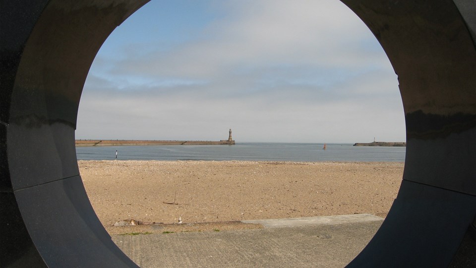
The fine views across the River Wear continue as you enter the city of Sunderland and follow the water's edge to the route's official end at the Star Map sculpture along the seafront at Roker.
Our C2C top tips
Where do I start?
The route is best ridden from west to east to take advantage of the prevailing winds.
The gradients are kinder this way round too, with longer downhill and shorter uphill sections.
Don't forget to follow tradition.
Most riders follow the tradition of dipping their back wheel in the Irish Sea at the start of the journey and their front wheel in the North Sea when they finish.
Which bike?
All bikes are suitable to tackle the C2C. There are off-road sections along the route, but you always have the option of taking the surfaced alternative.
Get a helping hand.
There are lots of companies who provide supported cycle rides if you don't want to carry all your equipment, we recommend Saddle Skedaddle.
Take in the artwork.
We commissioned some public artworks for this route, including Tony Cragg's 'Terris Novalis' and four steel cows by Sally Matthews at Consett.
Would you like more route inspiration? Sign up to our enewsletter.
Closure in Sunderland: River Wear
Along the River Wear in Sunderland, there are two parallel route options, both signed Route 7.
The route along the river has been closed by Sunderland City Council due to the construction of a new pedestrian and cycling bridge.
The parallel Sustrans route, also signed Route 7, is open and should be used instead.
Route distance options
Whitehaven - Sunderland: 133 miles, 215 kilometres
Workington - Sunderland: 125 miles, 202 kilometres
Whitehaven - Tynemouth: 137.5 miles, 222 kilometres
Workington - Tynemouth: 129.5 miles, 209 kilometres


Please note
We have taken all responsible steps to ensure that these routes are safe and achievable by people with a reasonable level of fitness.
However, all outdoor activities involve a degree of risk. To the extent permitted by law, Sustrans accepts no responsibility for any accidents or injury resulting from following these routes.
Walking and cycling routes change over time. Weather conditions may also affect path surfaces.
Please use your own judgement when using the routes based upon the weather and the ability, experience and confidence levels of those in your group.